
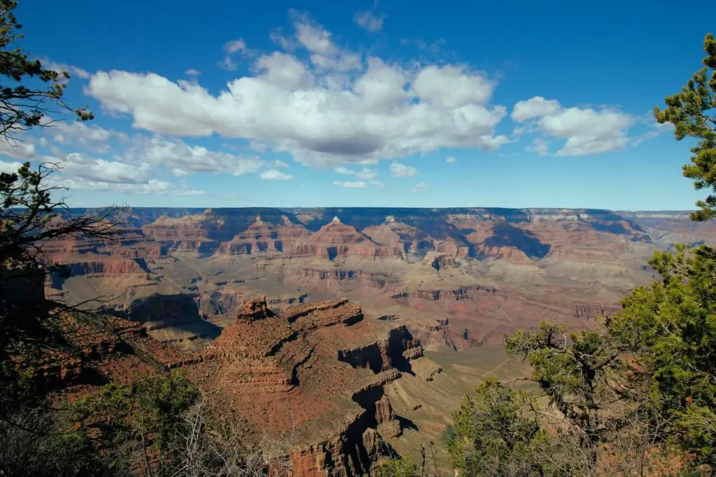
Grand Canyon National Park is located in the northwest of Arizona. This park features massive canyons, flowing rivers, and vast orange and brown vistas. This national park is one of the most visited parks in the world for the natural wonder and beauty it offers. Grand Canyon National park is split into two main areas, the Grand Canyon North Rim and Grand Canyon South Rim. The Grand Canyon South Rim is the more easily accessible area of the park with activities ranging from walk up view points, hikes deep into the canyon, biking along the rim, or even river rafting adventures. Driving from one rim to the other would take 220 miles, however you can hike from one end to the other in just 21 miles on the Kaibab Trail.
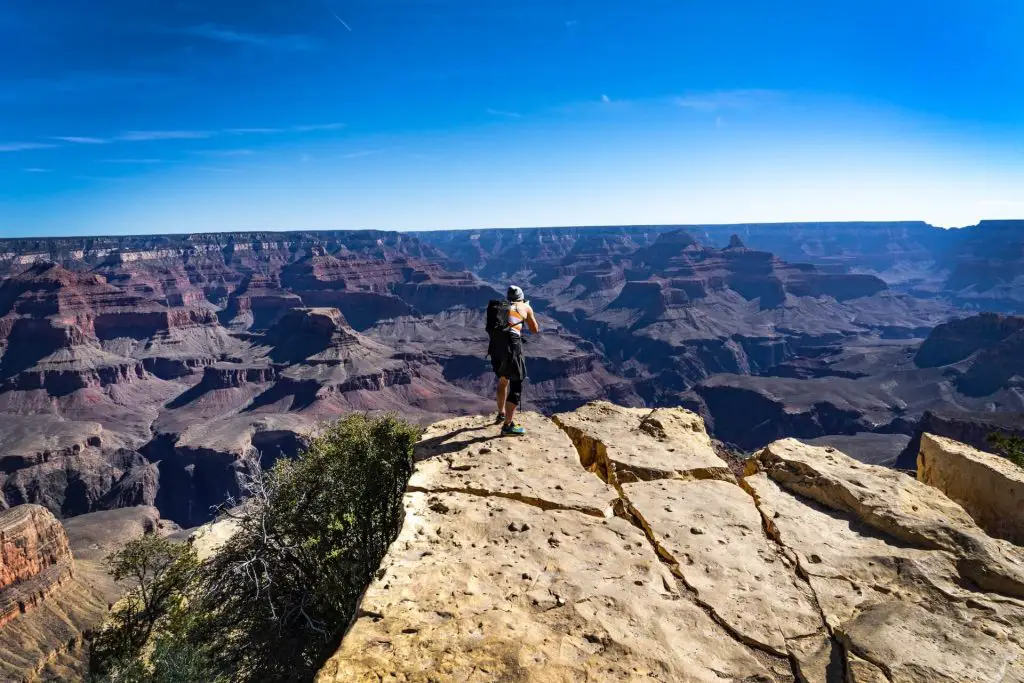
With so much to do and so many trails to hike in Grand Canyon National Park, I’ve helped narrow it down to the top 8 best hikes you absolutely should not miss in the Grand Canyon. In no particular order these hikes will take you from along the rim of the canyon, down the side of the cliffs edge near the canyon floor, and to panoramic viewpoints that you’ll never forget. Each trail is well established and offers a variety of sights and sounds. Keep in mind Grand Canyon is in a very dry and hot environment, so temperatures can get very hot very quickly, so be sure to bring enough water and try to hike earlier in the day as there are many search and rescue efforts to help hikers in need due to over heating or dehydration.
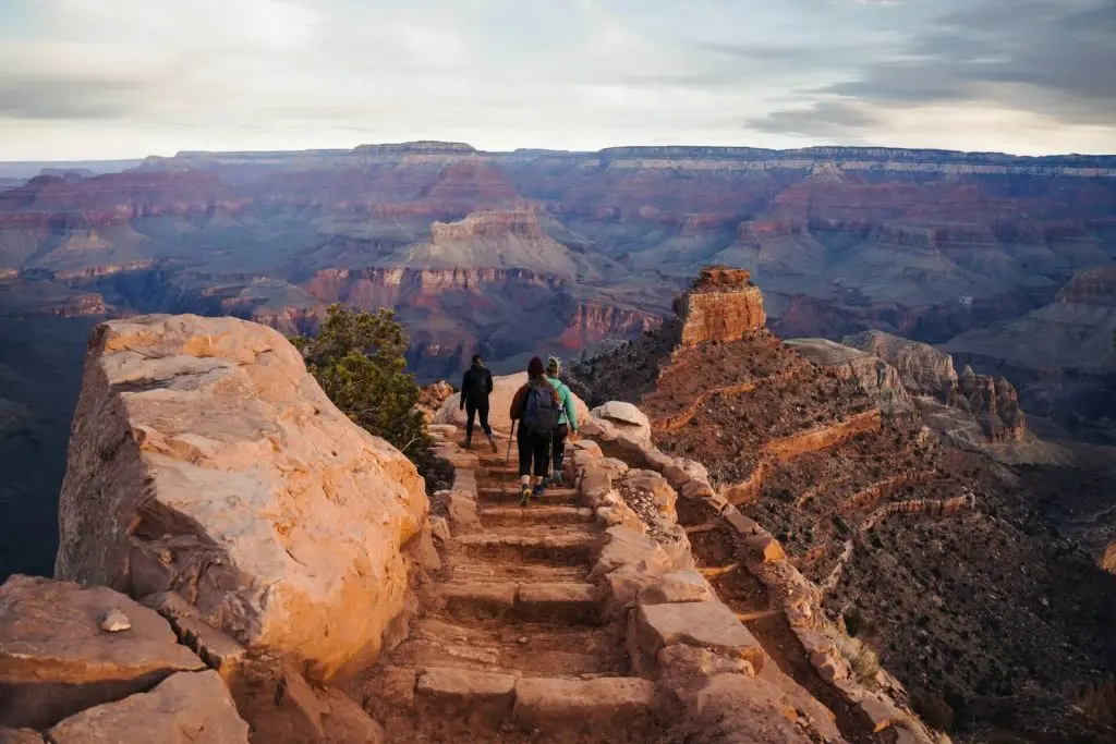
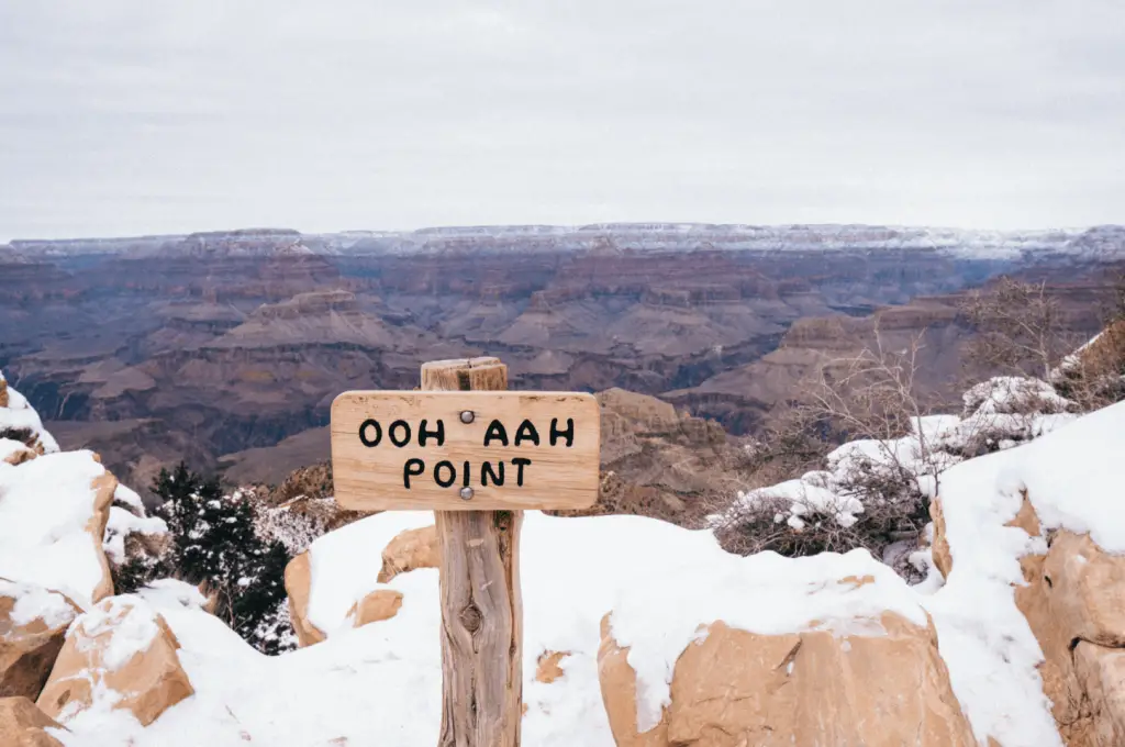
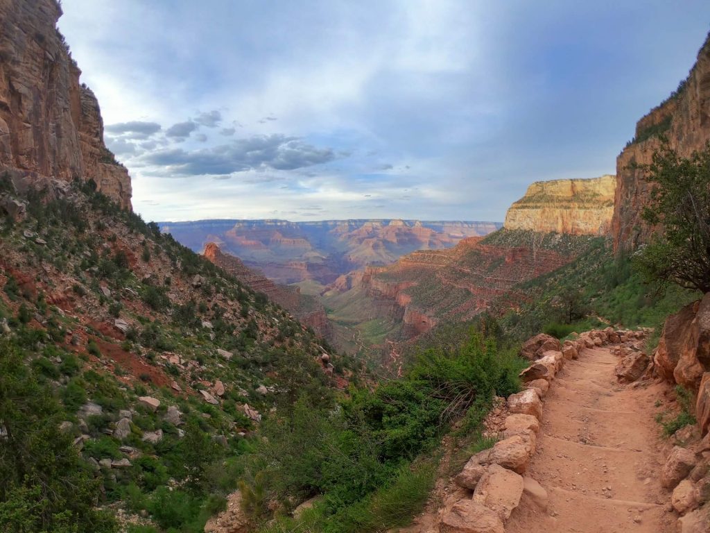
South Kaibab Trail to Ooh Aah Point
Distance: 1.7 miles
Elevation gain: 685 feet
Difficulty: Moderate
Duration: Two Hours
Trailhead: South Kaibab Trailhead Parking Area
https://goo.gl/maps/X55rmkHZ4Y99fHuv7
Trail description: South Kaibab Trail to Ooh Aah Point is a well established trail that takes you from the top of the South Rim, down into the canyon below. This trail features hiking along the canyon’s edge, many breathtaking views, and the main highlight of Ooh Aah point that makes many stop and say the trail’s name. This is a quintessential hike of the Grand Canyon and a can’t miss trail for all hikers.
Keep in mind: The hike towards Ooh Aah point is all downhill and the easy part, however you will pay for it on the return hike back to the trailhead as you’ll have to gain almost 700 feet in elevation in less than one mile.
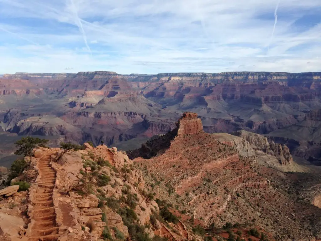
South Kaibab Trail to Cedar Ridge
Distance: 2.8 miles
Elevation gain: 1090 feet
Difficulty: Moderate
Duration: Two to three hours
Trailhead: South Kaibab Trailhead Parking Area
https://goo.gl/maps/izxLpkYmNcpPqf5m6
Trail description: This hike is an extension of the hike to Ooh Aah Point with an additional one mile to go deeper into the canyon. This hike gives hikers a chance to experience views of the Grand Canyon below the rim and sweeping views of the expansive canyon a little bit further down. One you reach Cedar Ridge, you’ll realize just how massive the canyon is as there is still so much more trail to get to the bottom of the canyon.
Keep in mind: This hike is a descent from the rim all the way to Cedar Ridge, so all of the elevation gain takes place on the return back with over 1,000 feet in elevation gain happening over less than 1.5 miles of hiking.
Rim-to-Rim: North Kaibab to Grand Canyon Village
Distance: 22.7 miles (through hike)
Elevation gain: 5,150 feet
Difficulty: Very Strenuous
Duration: 1 to 4 days (12-15 hours for one day trips)
Trailhead: North Kaibab Trail Parking Lot
https://goo.gl/maps/6UNFnQGGkRXyzRiK6
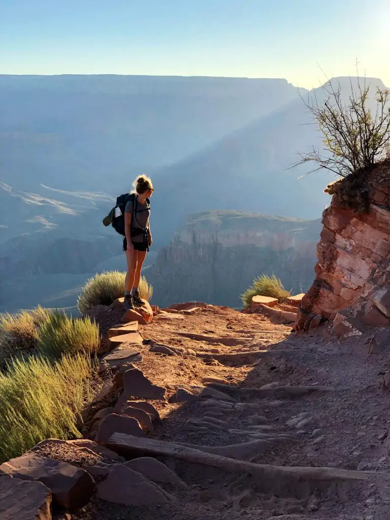
Trail description: This epic journey will take hikers from one rim of the Grand Canyon to the other rim on a 22 mile hike. This hike features fantastic panoramic views from the top of the canyon, to hidden gem waterfall, towering canyon walls, and so much more. This hike has so much for hikers to see and will take you deep into the Grand Canyon next to rivers and down steep switchbacks that hug the canyon’s walls. This is a once in a life time adventure that will leave you with unforgettable memories.
Keep in mind: This is an incredibly strenuous hike and many people train weeks to get ready for the challenge that is up ahead. The Grand Canyon is a desert environment and can get incredibly hot so hike early and bring plenty of water and electrolytes. This hike can technically be done in one day, however many take between two to four days and break up the trail in order to hike it at a more leisurely pace. Check for the lottery process to get permits in order to camp in the canyon if you’re doing this over a few nights. If you day hike it then no permit is needed, but start incredibly early as this will likely take you more than 12 hours to hike.
Bright Angel Trail to Bright Angel Campground
Distance: 18.4 miles(through hike)
Elevation gain: 4,980 feet
Difficulty: Very Strenuous
Duration: 9 to 12 hours
Trailhead: Backcountry Information Center Parking Lot (5 min walk to trailhead)
https://goo.gl/maps/Ptx3c6bn7ZhYJUMC9
Trail description: This hike takes hikers from 6,785 feet at Bright Angel Trailhead all the way down to Bright Angel Campground 4000 feet below the canyon’s rim. This hike features scenic views of the Grand Canyon walls from beneath the rim, red and orange sand covered trails along the edge of the canyon, a roaring Colorado River, and a walk across the Bright Angel Bridge over the river. This is an incredibly challenging yet rewarding hike for anyone looking for an unforgettable journey.
Keep in mind: This hike is very challenging and takes on average more than 9 hours to complete, so be sure that you are ready to handle this tough hike as many people get rescued by the search and rescue team due to overheating, exhaustion, or dehydration. The trail is exposed completely to the sun with very few spots of shade, so start early and bring plenty of sun protection. If you’re planning on staying at Bright Angel Campground you need to get permits.
Bright Angel Point Trail
Distance: 0.9 miles (out and back)
Elevation gain: 145 feet
Difficulty: Easy
Duration: 30 minutes
Trailhead: North Rim Visitor Center Parking Lot
https://goo.gl/maps/znZvgwSE4QSJfWnX7
Trail description: This short hike features grand views of the canyon on a paved road on a ridge-line path. On this hike you will be able to see spectacular views of the canyon buttes below, the red and orange canyon walls, and endless vistas in the distance. This is one of the more accessible trails as the path is entirely paved.
Keep in mind: This trail sits at 8,148 feet, so the high elevation, so the high elevation may leave you winded with each step you take.
Shoshone Point Trail
Distance: 2.1 miles (out and back)
Elevation gain: 150 feet
Difficulty: Easy
Duration: 1 hour
Trailhead: Small Gravel Lot off the AZ-64
https://goo.gl/maps/gAmmcgBrrz95V5vG8
Trail description: This lesser visited hike on Shoshone Point trail takes hikers through a pine wood forest to a plateau at the edge of the Grand Canyon. This trail features views of the expansive Grand Canyon vistas in the east and a worthwhile short hike. From the viewpoint you’ll be able to see formations such as the Desert View Tower, Vishnu Temple, Horseshoe Mesa, and many others. The plateau at the end offers epic photo opportunities for those brave enough to get on it.
Keep in mind: While the trail ends early before the edge, some thrill seekers go to the very edge of the canyon. Be very careful as there is lots of loose gravel and loose rocks that could lead to a deadly fall.
Yavapai Point via Rim Trail
Distance: 1.6 miles
Elevation gain: 80 feet
Difficulty: Easy
Duration: 45 minutes to 1 hour
Trailhead: Mather Point, Park at the Visitor Center and make your way west from Mather Point
https://goo.gl/maps/4dhTNakHhMCfxJH77
Trail description: An easy stroll on a paved road leads hikers to breathtaking views of the Grand Canyon. This hike features many scenic viewpoints along the trail. This hike is a nice break between other hikes or should be done during sunset. The trail is paved and easy to follow so its perfect for families with small kids.
Keep in mind: This trail has no sun cover and is completely exposed, so wear a hat and sun cover to help your body stay cool.
Grandview Trail to Horseshoe Mesa
Distance: 5.5 miles
Elevation gain: 2,385 feet
Difficulty: Very strenuous
Duration: 4 to 6 hours
Trailhead: Grand View Trail Parking Area
https://goo.gl/maps/5ed3FeA22xJjcSrPA
Trail description: This hike takes hikers down into the canyon down a series of switchbacks on a steep descent down to a the Cocoino Saddle. This trail is narrow in some parts, so hikers with fear of heights should trek carefully as there is exposure off the cliffside down to the canyo below. There is gorgeous scenic views on the entire way down as you’ll be able to see the canyon yo close and personal.
Keep in mind: The trail on the way down into the canyon is relatively mild as you’re going down hill and soaking in the views, however the hike on the way back to your car will be incredibly grueling as you have to gain over 2,000 feet in elevation gain over just a few short miles. Bring extra water as there is no water on the trail and minimal sun cover.
Relevant Questions
Whats the easiest hike in Grand Canyon?
The easiest hike in the Grand Canyon is the Bright Angel Point trail. Most trails average more than four miles long as the hikes mostly take place on the Kaibab or Bright Angel trails. The Bright Angel point trail is on a paved road and from the parking lot to the view point is less then half a mile. This is a leisurely stroll for most and offers gorgeous views of the vast Grand Canyon Vistas.
How long to hike to the bottom of the bottom of the Grand Canyon?
If you are in the South Rim of the Canyon it will take four to five hours over 6.8 miles to get from the top of the South Rim down to the Bright Angel Campground which is located at the bottom of the Canyon. If you are in the North Rim of the canyon then you have to hike down the Bright Angel Trail which will take you around five hours over 9.3 miles.
What is the prettiest part of the Grand Canyon?
The prettiest part of the Grand Canyon are the views you get as you hike into the Canyon. Being able to see the canyon from above the rim then making your way below the rim into the expansive canyon vista is something you’ve never seen before. Heading towards the rock formations and massive buttes, these are the prettiest areas of the park. Check out hikes on the Kaibab or Bright Angel trail to be able to see such sights.
Can you hike down the Grand Canyon in one day?
It is possible to hike from one rim of the Grand Canyon down to the bottom in one Day. Hikers can either go from the North Rim and down the Bright Angel trail towards Bright Angel Campground or from the North Rim. Each trail generally takes hikers between four and five hours to go from the rim to the bottom. The ascent up however will likely take five or more hours as going up the steep switchbacks will take you much longer.