
 Park Overview
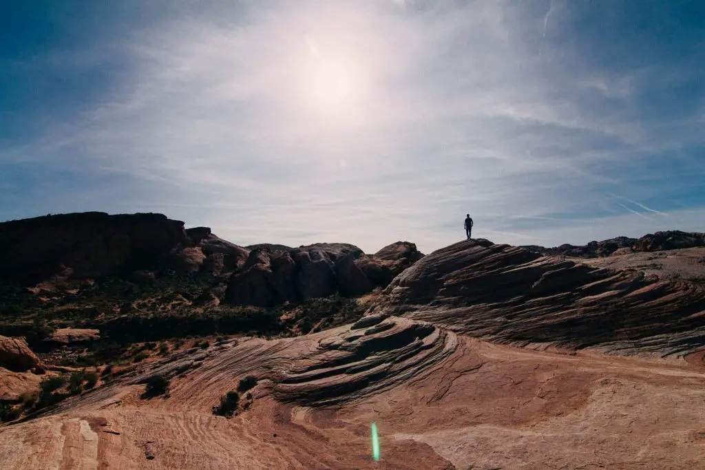
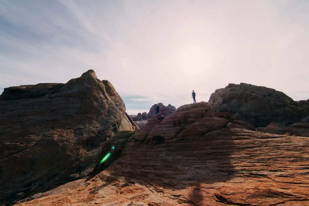
Situated in the Southeast corner of Nevada, just one hour outside of Las Vegas, sits a natural wonderland of red and orange sandstone rock formations. This state park features remarkable rock formations, beautiful canyons, and a breathtaking crimson landscapes that look like the surroundings are on fire. These element sculpted natural formations are just astonishing and offer miles of adventures for those looking for an outdoor haven just outside sin city.
Top 8 Best Hikes in Valley of Fire State Park
Hikers can transport them from the bustling city to a desolate yet beautiful rocky red vista in Valley of Fire State Park. The grand scale of the far-reaching rock formations make you feel like you’ve landed on Mars. This state park provides hikers with hundreds of miles to hike which will lead you to a fire wave, massive white domes, scenic canyon views, remarkable rock formations, and so much more. This state park is a natural wonder and offers fantastic hikes for all skill levels.
Elephant Rock Trail
Distance:0.3 miles (out and back)
Elevation gain: 52 feet
Difficulty: Easy
Duration: 10-15 minutes
Trailhead: https://goo.gl/maps/TWYbdcHkfCBPicmUA
Trail description: This short hike features a natural rock formation that looks like a massive elephant or huge mammoth frozen in time. This is a well established trail that takes you through the red sand Nevada desert right up to the elephant like stone structure. As you get closer you can see the trunk of the elephant, its back, and legs. This is a very cool stone structure and definitely worth the trip to see!
Keep in mind: This structure, while made of stone is likely very fragile, so please do not climb on it in order to help protect the structure. The trail to the elephant rock is short, but completely exposed with no sun cover, so be sure to wear a hat and sun protection!
Rainbow Vista Trail
Distance:1.5 miles (out and back)
Elevation gain: 150 feet
Difficulty: Easy
Duration: 45 minutes
Trailhead: https://www.google.com/maps/@36.4509716,-114.5155002,17z
Trail description: Rainbow Vista trail takes hikers through across the desert, past vibrant sandstone formations, up to crimson canyons, and to the top of a crest with sweeping panoramic views of the surrounding valley of fire. This trail is on mostly on red sand that leads you to many awesome photo ops. While the hike is short, the scenic views of the red rocks and various stone formations help keep things interesting.
Keep in mind: This trail is not well marked and you will be hiking through on a sandy desert floor. There is virtually very little elevation gain and the only gain is off the trail to the top of the viewpoint. This trail has no sun cover, so bring enough sun protection to help block out the sun.
Atlatl Rock
Distance:0.1 (out and back)
Elevation gain: 50 feet
Difficulty: Easy
Duration: 10 minutes
Trailhead: https://goo.gl/maps/atvrSDHkDrGz8ign7
Trail description: The Atlalt Rock trail winds back the clock to take hikers up close and personal with a cluster of petroglyphs along the top of a huge red orange boulder. This is a short walk up a series of metal stairs that are built on the side of the giant rock formation. The series of petroglyphs reveal activities from a time long ago. This hike is definitely worth a quick stop as a nice flashback and shows a piece of history from this beautiful land.
Keep in mind: The stairs can be pretty steep with just a metal guard rail to prevent you from a fall, so go up the stairs slowly. The petroglyphs are part of history and protected by the park, so look, but do not touch!
Fire Wave
Distance:1.5 miles (out and back)
Elevation gain: 175 feet
Difficulty: Easy
Duration: 1 hour
Trailhead: https://goo.gl/maps/dDwvdM4XNaPF4Rnh8
Trail description: The main attraction of the Valley of Fire is a fire wave that attracts hundreds thousands of visitors each year. This short hike brings you right onto the marvelous vermilion striped rock formation that wraps into a rising rock dome. The photos don’t do it justice and you won’t believe it until you see it in person, that there are red orange, pink, and white stripes on a natural rock formation. This well established trail will take you through the desert, past some alluring sandstone cliffs and right onto the fire wave itself. The views from the fire wave are just stunning as you stop and look around to see the pink and red rocks just stretching across the surrounding area.
Keep in mind: Since this is the main attraction of the state park, the hike can be very busy, so I suggest hiking this early to avoid the crowds. The best time to go here is during the off-season in the winter as there will be less people and temperatures will be much cooler. This trail is in the dessert with no trees, so expect zero sun cover on your hike. Bring enough water if you’re hiking here in the summer as temperatures can get over 100 degrees.
Natural Arch
Distance:4.2 miles (out and back)
Elevation gain: 230 feet
Difficulty: Easy
Duration: 2.5 hours
Trailhead: https://goo.gl/maps/4S51rXe4Vqqr3H9B9
Trail description: Situated in the eastern part of Valley of Fire lies a massive natural arch that has been sculpted by the elements. This trail presents hikers with a variety of red rocks that have been molded into various formations. The red and orange rocks against the backdrop of the blue desert sky offer pristine views of one of the remarkable arch formations in the valley. This short hike is fantastic.
Keep in mind: There are certain parts of the trail that will take you into deep sand, so watch your step. There are various patches of shade throughout the hike, but you will still be exposed to sun.
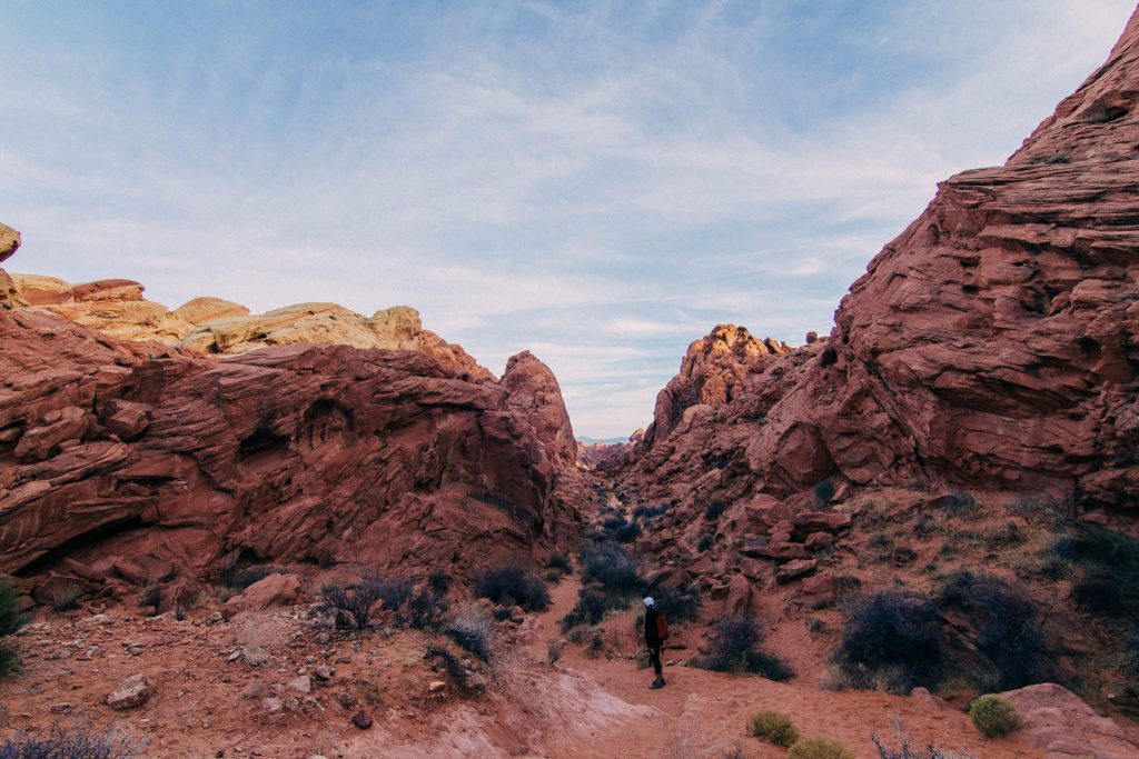
Petroglyph Canyon to Mouse’s Tank
Distance:0.8 miles
Elevation gain: 30feet
Difficulty: Easy
Duration: 15 minutes
Trailhead: https://goo.gl/maps/XYRrWbM6C7QkXweA7
Trail description: This short hike features a series of Native American rock art. Hikers will pass through the breathtaking natural red rock canyons and be able to see prehistoric art sprinkled throughout the canyon on the red sandstone walls. Walking along the trail and seeing the art just ads to the ambience and wonder of the valley of fire. This is the best location to see the Petroglyphs. The end of the trail features the Mouse’s Tank, a tub of water that lays between the sandstone.
Keep in mind: During this hike you will be walking in a sandy wash which will slow you down as you trudge your way through the trail. This trail also has minimal sun cover, so be sure to wear sun protection as temperatures can raise very quickly in the valley.
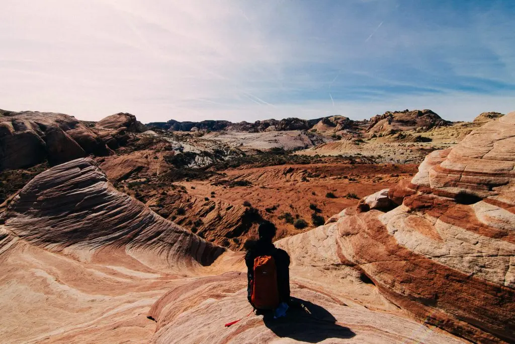
White Domes
Distance:1.1 mile (loop)
Elevation gain: 150 feet
Difficulty: Easy
Duration: 45 minutes
Trailhead: https://goo.gl/maps/ve619g8J6yi1ZSxD6
Trail description: This short hike transports hikers to a rocky wonderland filled with various beautiful natural sandstone formations, into an awe-inspiring canyon, through remarkable slot canyons, and to the top of white stones with breathtaking viewpoints. If there wasn’t a fire wave, this would be the feature hike of the park as it is jam packed with spectacular natural beautify each step of the way. This is an absolute must hiked and any hiker who visits the Valley of Fire must go on this hike.
Keep in mind: Since this hike is short and easily accessible it can get very crowded, so hike it early if you can to get the canyon all to yourself. This hike has some sun cover thanks to large canyon walls and lucky shadows, but for a majority of the trail you will be exposed to the sun, so bring enough water. The elevation gain is minor and only noticeable as you’re scrambling up certain spots, but nothing noteworthy.
Prospect Trail
Distance:8.8 miles
Elevation gain: 800 feet
Difficulty: Moderate
Duration: 4 to 5 hours
Trailhead: https://goo.gl/maps/a5qqpcm7q3AfBKwb7
Trail description: Prospect trail features a beautiful hike through the serene desert landscape with plenty of scenic views as you hike through slot canyons and along the massive sandstone walls. There are a few spots of scrambling and finessing over large boulders, but the effort is worth it for the beautiful scenery.
Keep in mind: Most of this hike is in a sandy wash, so watch your footing for loose gravel and deep sand. Certain parts of this trail are a bit ambiguous so be mindful of the path you take.
Relevant Questions Section
How much time do you need for Valley of Fire?
I recommend at least two full days for the Valley of Fire as there are so many hiking spots to see and not enough time to squeeze them into a few hours without feeling rushed. The hikes are unforgettable taking you to a fire wave, alluring red rock canyons, beautiful slot canyons, and more.
When should I visit Valley of Fire?
The best time to visit Valley of Fire is in the winter months when temperatures are much cooler and there are significantly less visitors. Visiting from December to February will make your experience much more enjoyable as there will be more camp spots open, less people on the trails, and not 100 degrees!
Can you bring dogs to Valley of Fire?
Valley of Fire State Park is a dog friendly park. If you plan on bringing your dog, you just need to put your dog on a leash. Dogs are allowed to be taken on the hiking trails as long as they are on their leashes. Be sure to bring a collapsible dog bowl to keep your dog properly hydrated. Also be sure to bring doggy bags to help clean up after your dog!